Header image  
Solving your pH worries  
line decor
  
line decor


Safe Contracto


GPS PRECISION FARMING


Technology
The Global Positioning System was established and is run by the US military. It has recently been made freely available for non-military use and has established itself in many practical applications.

GPS works by utilising a network of satellites orbiting the earth. This network consists of 24 satellites, 4 in each orbit equally spaced and 6 orbits in total at 55° inclinations 20200 metres above the earth.


h

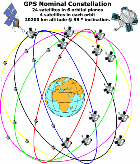
Each satellite emits a unique signal which is detected by GPs receivers on the ground. At any one time between five and eleven satellites are detectable. The GPs unit will select the four most appropriate satellites and then compute position, velocity and time from simple geometric calculations combined with some very advanced algorithms. This is the basis on which the field mapping and sample positioning system operates.

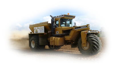
A GPs receiver is carried on the vehicle mapping the field. This can be linked to an onboard PC to provide real-time data as the field is being mapped and soil samples taken. Alternatively the handheld GPs unit can log data for downloading to a PC at a later date.

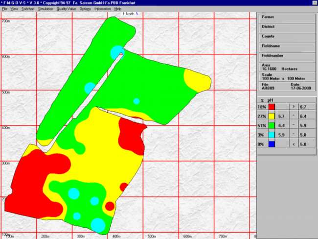
The PC mapping software will then produce an accurate field map with the positions of the various samples taken. Once the laboratory analysis of the soil is completed the results are entered into the field map file and and a soil type distribution analysis is then produced. This file and data is then used by the spreaders for accurate and efficient spreading of the lime.

field map


back UPMethodology

GPs Field Testing
Soil cores are divided into soil types before sending off for independent laboratory testing. This provides an economic and accurate guide to the P, K & Mg status across the field. Other trace elements and P.C.N's can also be tested for. The number of samples sent taken can be varied according to customer requirements. pH is usually tested on each individual core.

Sampling is done all year round with a light weight tractor fitted with GPs and a sampler. Winter and early spring testing is done with flotation tyres fitted. For late spring and summer a high clearance row crop machine with crop dividers is used.

Maps are produced to show any variation of the pH or nutrients across the field. As the nutrient variation are according to soil type Farmers can make good use of them with their existing equipment without the need to invest in expensive GPs equipment.


Flotation Spreaders
A delivered and spread service is offered for all the products we supply. The machines are mostly three wheel Big "A" type spreaders Capable of spreading with the minimum of crop damage or compaction. All operators are fully experienced and happy to meet individual customer requirements.

h


back UPBenefits
  • Accurate identification of variation in soil nutrients & pH
  • Practical useful maps, benefits gained with farmers existing equipment
  • Accurate application of Fertiliser and Lime
  • Precise area requiring treatment
  • Exact Quantities can be ordered
  • Clear records
  • Testing in crop problem areas can be targeted
  • Accurate field measurement
  • Flexible system, can be tailored to customers need
  • Low cost, identifying different soil types means fewer samples for laboratory analysis


h